Getting Around Boston: The Ultimate Transport Guide

Navigating a new city can sometimes feel like solving a Rubik's cube. But fear not, my fellow travelers! Boston, with its historic charm and modern conveniences, is surprisingly navigable.
Welcome to your Boston transport guide, the treasure map to getting around Boston with the finesse of a local and without needing a car. Whether you're visiting for the first time or looking for ways to explore Boston without a car, this guide will help you master the city's public transportation system, uncover hidden walking paths, and easily reveal the secrets of getting from one historic landmark to the next.
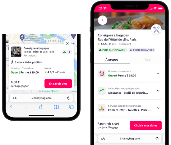
Now, for the savvy traveler who wants to experience Boston unencumbered by luggage, there's Nannybag. They offer a Boston South Station luggage storage service that's as convenient as it is secure. So, go ahead and explore those nooks and crannies of Beacon Hill or indulge in some downtown shopping; your bags are in good hands.
Embrace the Freedom of Boston on Foot
Walking is the unofficial pastime of Bostonians, and for good reason. Boston on foot is a delightful experience with historical treasures around every corner. Stroll along the Freedom Trail, a 2.5-mile walking tour that leads you through a storied past, or meander down to Faneuil Hall, where history meets modern-day market life.
As you wander through the city's charming neighborhoods, you'll discover cozy cafes, picturesque parks, and vibrant street art that add to the city's allure. Exploring Boston on foot allows you to immerse yourself in its rich history and vibrant culture, and it's the perfect way to uncover hidden gems that may be missed when using other forms of transportation.
From the Skies to the Streets: Logan International Airport to Downtown Boston
Touchdown at Logan International Airport, and you're a mere Blue Line subway ride away from the beating heart of Downtown Boston. The Silver Line also offers a direct route to South Station, a central hub that connects you to the rest of the Boston area.
The convenience of public transportation from the airport to the city center means you can start exploring Boston's attractions almost as soon as you land. Whether you're arriving for business or leisure, you'll find that Logan International Airport provides a seamless transition to the city's transportation network, making your journey from the skies to the bustling streets of Boston smooth and efficient. Plus, the views of Boston Harbor during your subway ride offer a scenic introduction to the city's waterfront beauty.

The Massachusetts Bay Transportation Authority (MBTA): Your Chariot Awaits
The public transportation system in Boston is a thing of beauty. Known to locals as the "T," the Massachusetts Bay Transportation Authority (MBTA) is your go-to for getting around the city. Let’s break down the colorful world of Boston’s subway lines.
The Red Line: Harvard and Beyond
Traverse the cerebral artery of Boston, from the hallowed halls of Harvard to the bustling Downtown. The Red Line is like the city's main artery, connecting some of its most iconic destinations. Start your journey in Cambridge, where you can explore the prestigious Harvard University campus and its intellectual ambiance.
As you ride further south, you'll find yourself in the heart of Downtown Boston, surrounded by historic sites, vibrant neighborhoods, and world-class dining. Whether you're a student, a history buff, or a foodie, the Red Line has something to offer everyone as it takes you on a captivating journey through Boston's intellectual and cultural landscape.
The Orange Line: The Community Connector
Running from North Station through the historic Beacon Hill and down to the forested Jamaica Plain, this line is a cultural cross-section of the city. The Orange Line is a true community connector, linking neighborhoods with distinct personalities and stories to tell. Begin your adventure at North Station, where you can catch a game at the TD Garden or explore the charming streets of Beacon Hill, known for its historic charm and picturesque architecture.
Continue your journey through diverse neighborhoods like Roxbury and Jamaica Plain, each offering its unique blend of culture, cuisine, and character. The Orange Line invites you to explore the rich tapestry of Boston's communities and discover the hidden gems that make each stop along the way a unique experience.
The Green Lines: Your Ticket to Fenway
In a city of Sox fans, the Green Line is the vein that leads to Fenway Park. But it's not just baseball; the Museum of Fine Arts and Boston Common are also on this route. The Green Lines are your ticket to some of Boston's most beloved attractions. Whether you're a die-hard Red Sox fan heading to Fenway Park or an art enthusiast exploring the Museum of Fine Arts, the Green Line has you covered.
You can also hop off at Boston Common, the city's iconic public park, where you can enjoy picnics, strolls, and outdoor concerts. The Green Line branches out into multiple routes, each offering its unique blend of culture and entertainment, making it a versatile and vibrant part of Boston's transport system.
The Blue Line: To the Sea and the Sky
Connect from the airport or head to the shores of Revere Beach. The Blue Line is your coastal companion in the Boston transport system. The Blue Line offers a unique blend of city and seaside experiences. If you're arriving at Logan International Airport, the Blue Line provides a convenient connection to the heart of Boston, allowing you to start your journey from the moment you touch down.
But it's not just about city life; the Blue Line also takes you to the shores of Revere Beach, where you can soak in the sea breeze and enjoy the sandy shores. Whether you're a traveler, a beach enthusiast, or someone looking for a scenic escape, the Blue Line offers a refreshing and rejuvenating journey that combines the best urban and coastal experiences in Boston.
Boston's Bus Lines: The Roads Less Traveled
Beyond the subway system, a web of bus lines weaves through Boston, offering routes that the subways don’t cover. Boston's buses are like hidden gems waiting to be discovered, taking you to neighborhoods and destinations that may not be as easily accessible by subway. Whether you're looking to explore the vibrant streets of Dorchester, take in the scenic views along the Charles River, or visit the historic sites of Charlestown, Boston's bus network has you covered.
With digital trackers and apps to update you on times, it’s a system that's become more user-friendly over the years. Planning your bus journey is a breeze with real-time information at your fingertips, ensuring you can confidently venture off the beaten path and uncover the city's lesser-known treasures.
Ticket to Ride: Passes and Payments
To avoid fumbling for change, pick up a CharlieCard. These reusable cards can be loaded with value for pay-as-you-go access or topped with weekly passes for unlimited rides. For visitors, this means saying goodbye to ticket lines and hello to smooth sailing (or, well, riding).
CharlieCards are your passport to Boston's public transportation system, offering convenience and flexibility. Load them up, tap and go—it's that simple.
Plus, having a reusable card streamlines your travels and contributes to a greener, more sustainable Boston. So, whether you're hopping on a bus, boarding the subway, or taking the commuter rail, having a CharlieCard in your pocket ensures that your Boston transit experience is efficient and eco-friendly.
Navigating the Nooks and Crannies of Boston
Each neighborhood in Boston has its own rhythm, and the public transportation system is well-tuned to match. Need to get to a Red Sox game? The Green Line drops you right at Fenway Park, making it a breeze for sports enthusiasts to catch a game at this iconic stadium. Looking for some Italian flair?
The Orange Line will whisk you to the North End, where the narrow streets are lined with charming cafes, pastry shops, and historic landmarks. Whether searching for cultural experiences, culinary delights, or historical sites, Boston's public transportation system is your ticket to exploring the diverse neighborhoods that give the city its unique character. With easy access to subways and buses, you can seamlessly hop from one neighborhood to another, uncovering the hidden gems that make each part of Boston special.

The Perks of Being a Pedestrian
Boston's heart beats strongest when you're on foot. The city's layout is the perfect grid for a leisurely... ahem, an exciting exploration without ever feeling lost. Wander from the Boston Common to the North Station, all within a 30-minute walk, and the blend of historic architecture and modern city life will enchant you.
And if you're in town for a conference or a game, Boston’s compact city center means you’re never too far from your next destination. Whether you're strolling through the charming streets of Beacon Hill, window shopping on Newbury Street, or enjoying the scenic views along the Charles River Esplanade, exploring Boston on foot allows you to fully immerse yourself in the city's vibrant atmosphere. Plus, you might stumble upon cozy cafes, local boutiques, and picturesque parks that you wouldn't have discovered otherwise.

Say hello to exploring and goodbye to heavy bags!
What if you could enjoy every minute in the city without the burden of your bags?
- Safe luggage storage for a flat daily price of $4.50/luggage item
- Included luggage protection of up to €10000 in case of breakage, loss or theft
